
Walk a Queen Creek Street
A sound Queen Creek street directory search moves from place to record, not from a name to a quick guess. The parcel roll identifies the recorded owner and gives the parcel number, or APN. The map then reveals the lots that line the same block. A recorder search can connect each owner to the deed that transferred title. Historic householder sections may add an adult who was listed at an older address. Each source describes a different fact, so ownership, tax mail, permits, and occupancy must stay separate.
Start with the town boundary and county. A Queen Creek postal line may point to Maricopa County, Pinal County, incorporated Queen Creek, or an area beyond the town. The official town guidance calls for checking “Do I Live in QC?” before choosing a county system. Once that choice is sound, use this street-by-street sequence:
- Confirm the town boundary and county, then search the correct assessor by the situs address.
- Save the APN, owner, separate mailing address, subdivision or plat reference, and deed number.
- Open the county GIS and click the parcel polygons along the chosen street segment.
- Use the deed number or owner name in the correct recorder index, checking the legal description.
- Use Arizona's voter portal only for an authorized self-check; it is not an anonymous street-roll browser.
- For an older street, compare the 1958, 1960, and 1963 householder divisions without treating them as current rolls.
This path establishes recorded facts. Matching a mailing address to a property address can support owner occupancy, but it never proves it. A different mailing address points to an offsite tax contact, not to the name of a person at the home.
Queen Creek Street Geography
County comes before street. Most incorporated Queen Creek parcels lie in Maricopa County, but a southeastern part of town lies in Pinal County. Annexation does not move a parcel across the county line. Encanterra, for example, entered Queen Creek while remaining in Pinal County. Postal city, fire or water service, school district, and the municipal planning area are also separate layers.
This geography controls the address search. A search in only one county can miss a valid Queen Creek address, while a postal result can include land outside town limits. Check the town map, county parcel map, and USPS form as distinct tests. If an old record uses a different ZIP, retain both versions as search terms. That is a boundary clue, not proof that the street moved.
Note: A Queen Creek mailing address does not prove that a parcel lies inside the town or in Maricopa County.
Search Queen Creek Streets by Address
The Maricopa County Assessor Parcel Search accepts an APN, owner, standardized address, subdivision, or MCR reference. For a stubborn address, omit city, state, ZIP, and sometimes the street type. The Pinal County path uses the Pinal County Assessor Parcel Search, whose address form breaks the location into parts. Both are free public starting points.
The Pinal fields matter because a broad name or a single long address string may fail. Search by street number and street name first. Subdivision or land-survey fields provide another route when the postal line has changed.
| Field | Control | How It Helps |
|---|---|---|
| Owners Name | Text | Uses LAST FIRST NAME format |
| Street Number, Direction, Name, Suffix, Unit | Text and select | Builds a Queen Creek address in parts |
| Book, Map, Parcel, Split | Text and select | Searches the APN components |
| Subdivision Name | Text | Groups parcels under a recorded subdivision |
| Section, Township, Range | Select trio | Finds land through survey geography |
| Cabinet, Slide, Lot | Text trio | Connects a parcel to its plat reference |
Browse Queen Creek Parcels in GIS
The assessor map turns one address into a visible street segment. In Maricopa GIS, use the magnifier, choose “What I Know,” enter an APN, address, or owner, select the address suggestion, and click the parcel polygon. The Results panel links the mapped shape back to parcel facts. Pinal GIS also supports address, APN, subdivision, and county map layers.
Map adjacency is valuable. It shows which parcels touch and whether a road, wash, tract, or split lot interrupts the apparent block. Click each polygon instead of drawing conclusions from roof lines. The assessor card remains the record; GIS supplies shape and layer context. Neither county viewer was verified to provide a public one-click resident list.
The street-directory image below comes from the official Maricopa County assessor search.
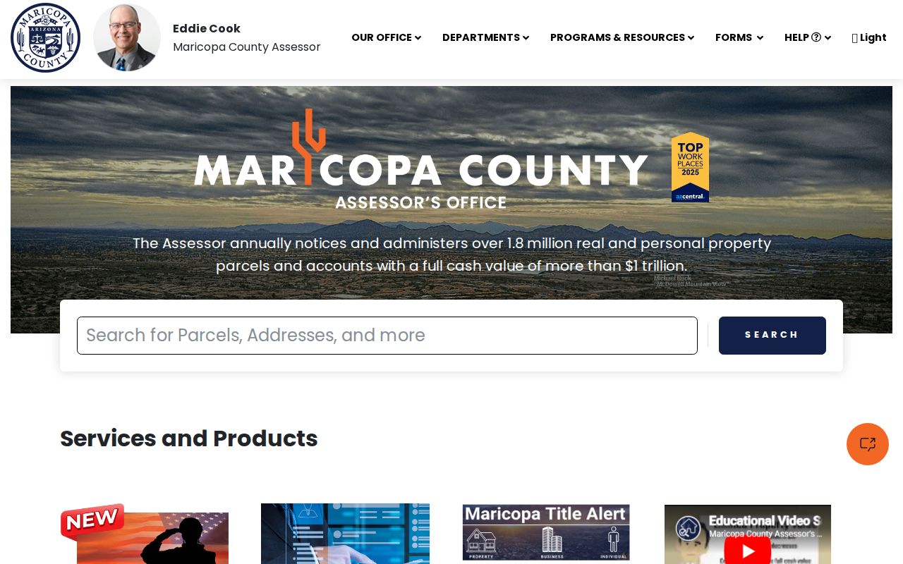
The search screen shows why a parcel number and standardized street address are stronger keys than a postal-place label alone.
Queen Creek Street Record Coverage
No single Queen Creek street directory is a live roster. Instead, several address-keyed records answer narrower questions. The assessor and tax rolls concern parcels and billed owners. GIS supplies the block pattern. Recorded deeds and plats document title and mapped lots. Development Nexus adds public project history. Historic directories can identify a listed adult at an older address.
| Record Set | Keeper | What It Shows | Access |
|---|---|---|---|
| Assessor roll | Correct county assessor | Owner, separate situs and mailing address, APN, value and subdivision | Free name, address, or APN search |
| GIS parcel map | Maricopa or Pinal County | Parcel shapes, adjoining lots, districts and layers | Free interactive viewer |
| Recorded documents | Correct county recorder | Grantor, grantee, deed, lien, plat and legal description | Free index; copy terms vary |
| Tax roll | County treasurer | Billed owner, mailing address, year and tax status | Free current and annual data |
| Permits and code | Queen Creek Development Services | Project, permit, complaint, or address history | Public history; detailed files by request |
The APN is the cleanest bridge. It ties the assessor card to a map, subdivision, deed reference, and often a permit search. Preserve each record’s date. A fresh deed may appear before the assessor updates its ownership roll, and Maricopa reports about a 72-hour lag before a new document becomes searchable by name.
Queen Creek Street Directory Terms
Four terms prevent common address mistakes. They separate the land, its official location, its recorded map, and an older occupancy clue.
- Parcel
- A mapped unit of land tracked by a county APN.
- Situs address
- The physical property address, kept apart from the owner’s mailing address.
- Plat
- A recorded map showing subdivision lots, tracts, streets, and related dimensions.
- Criss-cross directory
- A directory arranged by street and address rather than only by surname.
These labels also limit claims. A parcel has a recorded owner. A directory has a listed householder. A deed has indexed parties. None of those labels means that every person at the address has been found.
Link Queen Creek Streets to Deeds
After finding an owner or deed number, move to the county recorder. The Maricopa Recorded Documents Search accepts document number, docket or book and page, business name, personal name, document type, and date range. Its main party index reaches 1871 and contains more than 52 million searchable documents. Yet address and legal-description full-text research covers only the latest two years. That narrow full-text window is a major street-search quirk.
Pinal parcels use the Pinal County Recorder Acclaim search. Its online run begins May 23, 1980. Search a deed’s seller as the buyer on an earlier transfer, while matching the legal description or plat. Maricopa provides free unofficial images; official copies are $1 per page and certification adds $3 per document. Pinal offers free watermarked images where available, with the same official-copy and certification amounts.
Note: Deeds prove title transfers, not that a named owner lived at the Queen Creek situs address.
Queen Creek Permits by Street
Queen Creek Development Nexus covers building, zoning, engineering, traffic, projects, permits, and code complaints. Anonymous visitors may search project history. A record number is the strongest input, while address, parcel, and project criteria can vary by module. Account access does not make every document public.
Detailed plans, correction reports, record comments, and processing details are limited to verified applicants, contractors, or associated users. Others can use the Town’s General Records request channel. Digital inspection and emailed files are generally free. Describe the address, record type, date range, parcel or permit number, and desired digital format. Permits date work or applications; they do not prove who occupied the site.
Older Queen Creek Street Listings
The verified Queen Creek-tagged Mullin-Kille directories for 1958, 1960, and 1963 contain street and householder divisions. Their format suits the area’s pre-suburban rural routes and east-side or west-side abbreviations better than a modern street-number assumption. Search the address section, then confirm any listed adult in the alphabetical section.
Older place names widen the search. Queen Creek was once tied to Rittenhouse, while nearby evidence can appear under Higley, Combs, or Chandler Heights. A current street name may also preserve a founding family surname, including Ellsworth, Power, Sossaman, Hawes, Combs, or Schnepf. The full shelf and entry format belong in the Queen Creek directory book; the street directory uses those editions only as past address clues.
Queen Creek Street ZIP Changes
Postal history can break an exact address search. On July 1, 2009, 85242 became 85142 and 85240 became 85140 as Pinal-area ZIP prefixes shifted. On July 1, 2023, new ZIP 85144 split from 85142. Search both the old and current form in deeds, permits, news archives, and directory indexes.
No official townwide street-renumbering year was verified. Do not invent one to explain a failed match. Use the APN, recorded subdivision, plat, lot, and legal description as bridges. Those land keys tend to outlast changes in postal line, annexation status, or ZIP code.
Note: ZIP codes route mail, while town and county boundaries decide which Queen Creek office holds the record.
When Queen Creek Street Search Stops
Online gaps have defined fallbacks. For a Maricopa record, the Recorder counter is at 301 W. Jefferson Street, Suite 200, Phoenix, weekdays from 8 a.m. to 5 p.m.; phone 602-506-3535. For a Pinal deed before May 23, 1980, use the Recorder at 31 N. Pinal Street, Building E, Florence, call 520-509-3555 or 888-431-1311, or mail PO Box 848, Florence, AZ 85132. Bring the party name, date range, last known document, APN, subdivision, and legal description.
A missing assessor extract or historical transfer item may also be requested from its county custodian under Arizona Public Records Law. Do not send that request to the Queen Creek Town Clerk. The Town links both counties as a routing service but does not keep county deeds. Libraries and archives add maps, directories, newspapers, and context, while only the recorder supplies the land instrument.
The Queen Creek Library at 21802 S. Ellsworth Road provides a shared local access point even though county records split. All incorporated town residents qualify for a free Maricopa County Library District card regardless of county. The branch can help with licensed genealogy and newspaper resources, but it does not certify a deed or replace a recorder search. For older community ties, the San Tan Historical Society preserves class photographs from 1926 onward, oral histories, manuscripts, and farm-community material at Old Rittenhouse School.
Limits of Queen Creek Street Records
Queen Creek address records cannot supply a complete household roll. Renters and family members are not assessor fields. No public utility-customer list was verified. The Arizona voter portal is an identity-gated self-service tool, not an anonymous street browser. Motor-vehicle addresses are restricted, and protected addresses may be suppressed from county and election systems.
Use exact record labels. “Recorded owner,” “tax mailing address,” “permit applicant,” and “directory-listed householder” communicate what the source proves. They also guard against mistaking a contractor, association contact, owner, or old directory entry for a present occupant.
Lawful use. Queen Creek address records support family history, deed research, and civic inquiry. Never use them to stalk, harass, intimidate, or reconstruct a protected address.
If a result disappears, treat protection as a possible explanation rather than a portal failure. Confirm only through the lawful custodian channel and leave shielded information private.